
Visit Tremont for a Day
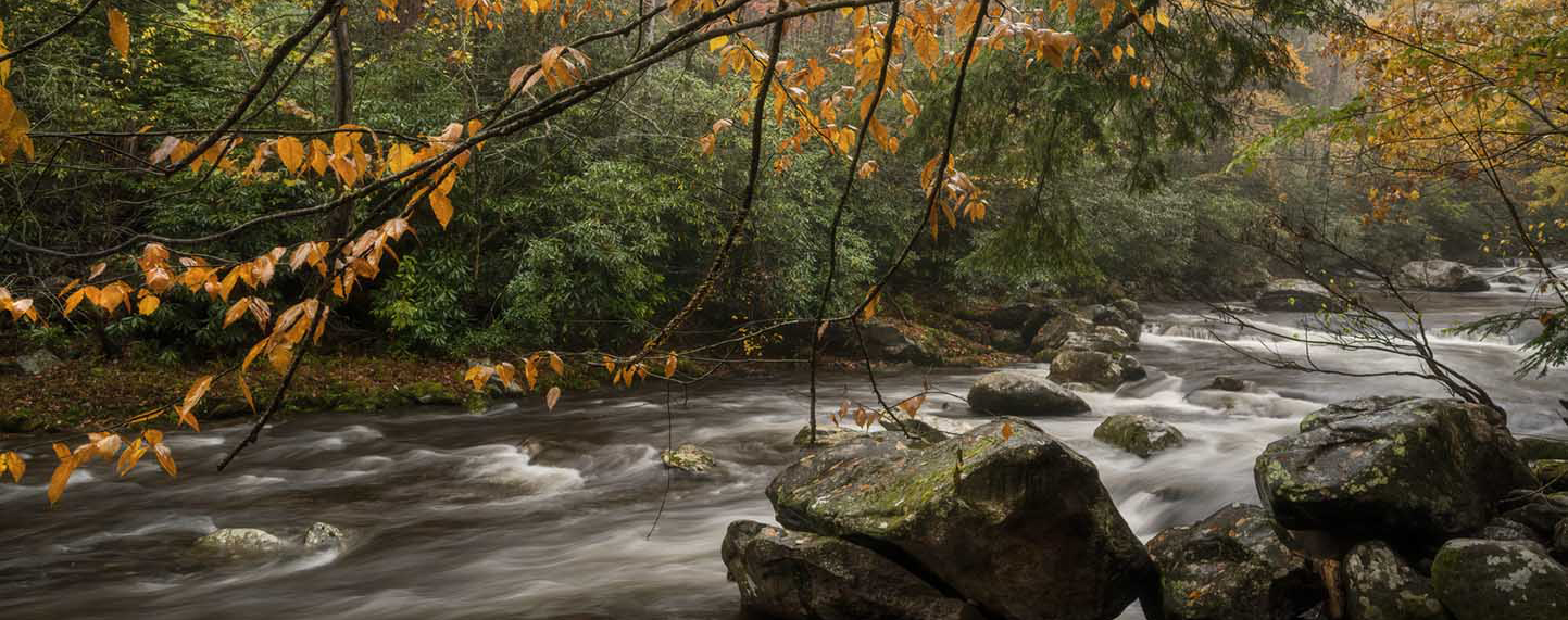
Nestled within the quieter side of Great Smoky Mountains National Park, Tremont Institute offers not only access to incredible hiking but also a place to reconnect with nature through education, reflection, and discovery. Whether you’re here for a waterfall hike or just passing through the Townsend entrance, stop by our home in Walker Valley and explore all that Tremont has to offer.
Plan Ahead for a Deeper Nature Experience
If you’re looking for something more than a hike — something that stays with you long after you leave the trail — consider joining a Tremont program. Whether it’s a photography workshop, a guided family experience, or a weekend retreat, our residential programs are designed to immerse you in the beauty, rhythms, and wonder of the Smokies. Check out our upcoming programs.
Recommended Hiking Trails
Here for the trails? You’re in the right place! Each of these hikes starts from or near the Tremont campus. Please hike responsibly and safely and practice Leave No Trace principles. For more information about hiking in Great Smoky Mountains National Park and to download a trail map, visit the park’s official website. Parking passes, trail maps, and hiking guides can also be purchased at Tremont’s Visitor’s Center.

Spruce Flats Falls (1.8 miles round trip, moderate)
A short but rewarding trail leading to a beautiful multi-tiered waterfall — great for families and photographers alike. To access the Spruce Flats Falls trailhead, park in the Tremont Institute Visitor Center parking lot. Walk up the gravel service road, and take a left at the Tremont dorms onto the Lumber Ridge trail. About 50 feet onto the trail, you’ll come to a split – follow the “falls” sign to the right. This trail includes some steep rocky sections that may be challenging; sturdy footwear is highly recommended.
The trail to Spruce Flats Falls is managed and maintained by Tremont Institute using private funds. In Spring 2025, the trail received significant repairs, thanks to the support of Athletic Brewing and Blackberry Farm Foundation. If you love this trail, consider making a gift to help us preserve it.

Middle Prong Trail (up to 8.2 miles, easy to moderate)
Stroll alongside cascading streams and waterfalls on one of the park’s most scenic and historic trails. You’ll walk along the Middle Prong for most of the trail, and will pass multiple waterfalls, as well as some interesting remnants of the park’s history along the trail. About half a mile into the hike, you’ll encounter Lynn Camp Prong Cascade; take some time to sit on the bench and enjoy the view. Walk as far as you like, turn around, and head back to your car.
If you’re feeling adventurous, take the small, unmarked trail on the right about 4 miles in to access Indian Flats Falls, but watch your footing in this area!

West Prong to Campsite 18 (4 miles round trip, moderate)
Want to test out your backcountry gear and skills before heading too far into the woods? Try campsite 18 on the West Prong Trail. You’ll experience a gradual incline and an easy stream crossing before arriving at the lovely campsite – a perfect spot to rest! If you want a little extra adventure, cross the footbridge on the other side of campsite 18 and head to the junction with Bote Mountain Trail.
Want to check out some Walker Valley history? Take a mini-detour from Tremont’s campus to the Walker family cemetery – take a right at the split by the West Prong trailhead, and you’ll find the cemetery at the top of the hill.
Start Your Trip at the Tremont Visitor Center
Our friendly staff can help you choose the right hike, share local insights, and introduce you to Tremont’s deeper purpose — helping people form lasting connections with nature.
Browse our thoughtfully curated gift shop featuring Smokies books and field guides, locally made goods, outdoor gear, and souvenirs from your trip. All proceeds support environmental education programs that bring students, teachers, and families into the national park to learn and grow together.
Parking Tags
Great Smoky Mountains National Park does not charge an entrance fee. However, parking tags are required for all vehicles parking for longer than 15 minutes. Parking tags are available for purchase online or in person; the Tremont Visitors Center sells tags during regular business hours.
Public parking is available by the Tremont Visitors Center or in the gravel lot across the bridge at 9275 Tremont Road.
Great Smoky Mountains National Park Information
Stay in Touch!
Share your experiences! Tag us on social media and let us know what you discovered on your adventure.
Photos by Jennifer Haralamos and Kimberly Weber.
Visit Tremont for a Day
Nestled within the quieter side of Great Smoky Mountains National Park, Tremont offers not only incredible hiking but also a place to reconnect with nature through education, reflection, and discovery. Whether you’re here for a waterfall hike or just passing through the Townsend entrance, stop by and explore all that Tremont has to offer.
Start Your Trip at the Tremont Visitor Center
Our friendly staff can help you choose the right hike, share local insights, and introduce you to Tremont’s deeper purpose — helping people form lasting connections with nature.
Browse our thoughtfully curated gift shop featuring Smokies books and field guides, locally made goods, outdoor gear, and souvenirs from your trip. All proceeds support environmental education programs that bring students, teachers, and families into the national park to learn and grow together.
Parking Tags
Great Smoky Mountains National Park does not charge an entrance fee. However, parking tags are required for all vehicles parking for longer than 15 minutes. Parking tags are available for purchase online or in person; the Tremont Visitors Center sells tags during regular business hours.
Public parking is available by the Tremont Visitors Center or in the gravel lot across the bridge at 9275 Tremont Road.
Plan Ahead for a Deeper Nature Experience
If you’re looking for something more than a hike — something that stays with you long after you leave the trail — consider joining a Tremont program. Whether it’s a photography workshop, a guided family experience, or a weekend retreat, our residential programs are designed to immerse you in the beauty, rhythms, and wonder of the Smokies. Check out our upcoming programs.
Recommended Hiking Trails
Here for the trails? You’re in the right place! Each of these hikes starts from or near the Tremont campus. Please hike responsibly and safely and practice Leave No Trace principles. For more information about hiking in Great Smoky Mountains National Park and to download a trail map, visit the park’s official website. Parking passes, trail maps, and hiking guides can also be purchased at Tremont’s Visitor’s Center.
Spruce Flats Falls (1.8 miles round trip, moderate)
A short but rewarding trail leading to a beautiful multi-tiered waterfall — great for families and photographers alike. To access the Spruce Flats Falls trailhead, park in the Tremont Institute Visitor Center parking lot. Walk up the gravel service road, and take a left at the Tremont dorms onto the Lumber Ridge trail. About 50 feet onto the trail, you’ll come to a split – follow the “falls” sign to the right. This trail includes some steep rocky sections that may be challenging; sturdy footwear is highly recommended.
The trail to Spruce Flats Falls is managed and maintained by Tremont Institute using private funds. In Spring 2025, the trail received significant repairs, thanks to the support of Athletic Brewing and Blackberry Farm Foundation. If you love this trail, consider making a gift to help us preserve it.
Middle Prong Trail (up to 8.2 miles, easy to moderate)
Stroll alongside cascading streams and waterfalls on one of the park’s most scenic and historic trails. You’ll walk along the Middle Prong for most of the trail, and will pass multiple waterfalls, as well as some interesting remnants of the park’s history along the trail. About half a mile into the hike, you’ll encounter Lynn Camp Prong Cascade; take some time to sit on the bench and enjoy the view. Walk as far as you like, turn around, and head back to your car.
If you’re feeling adventurous, take the small, unmarked trail on the right about 4 miles in to access Indian Flats Falls, but watch your footing in this area!
West Prong to Campsite 18 (4 miles round trip, moderate)
Want to test out your backcountry gear and skills before heading too far into the woods? Try campsite 18 on the West Prong Trail. You’ll experience a gradual incline and an easy stream crossing before arriving at the lovely campsite – a perfect spot to rest! If you want a little extra adventure, cross the footbridge on the other side of campsite 18 and head to the junction with Bote Mountain Trail.
Want to check out some Walker Valley history? Take a mini-detour from Tremont’s campus to the Walker family cemetery – take a right at the split by the West Prong trailhead, and you’ll find the cemetery at the top of the hill.
Stay in Touch!
Share your experiences! Tag us on social media and let us know what you discovered on your adventure.
